But the more we learn about Thwaites, the more profoundly we understand that many of our predictions about the speed of sea-level rise are extremely tenuous. As the first people to ever survey the calving edge of the world’s widest glacier, our mission is to bring back as much preliminary information as possible. After our return, these data will be used to begin to refine our climate-change models and to strategize the remaining years of the International Thwaites Glacier Collaboration (ITGC). For instance, it will inform a pair of studies, published in Nature, that suggest that, while the underside of Thwaites is melting less quickly than previously suspected, deep and rapidly expanding cracks in the ice could trigger the shelf’s collapse. Put another way: At the cold nadir of the planet, Thwaites continues to step outside the script we imagined for it, defying even our most detailed projections of what is to come.
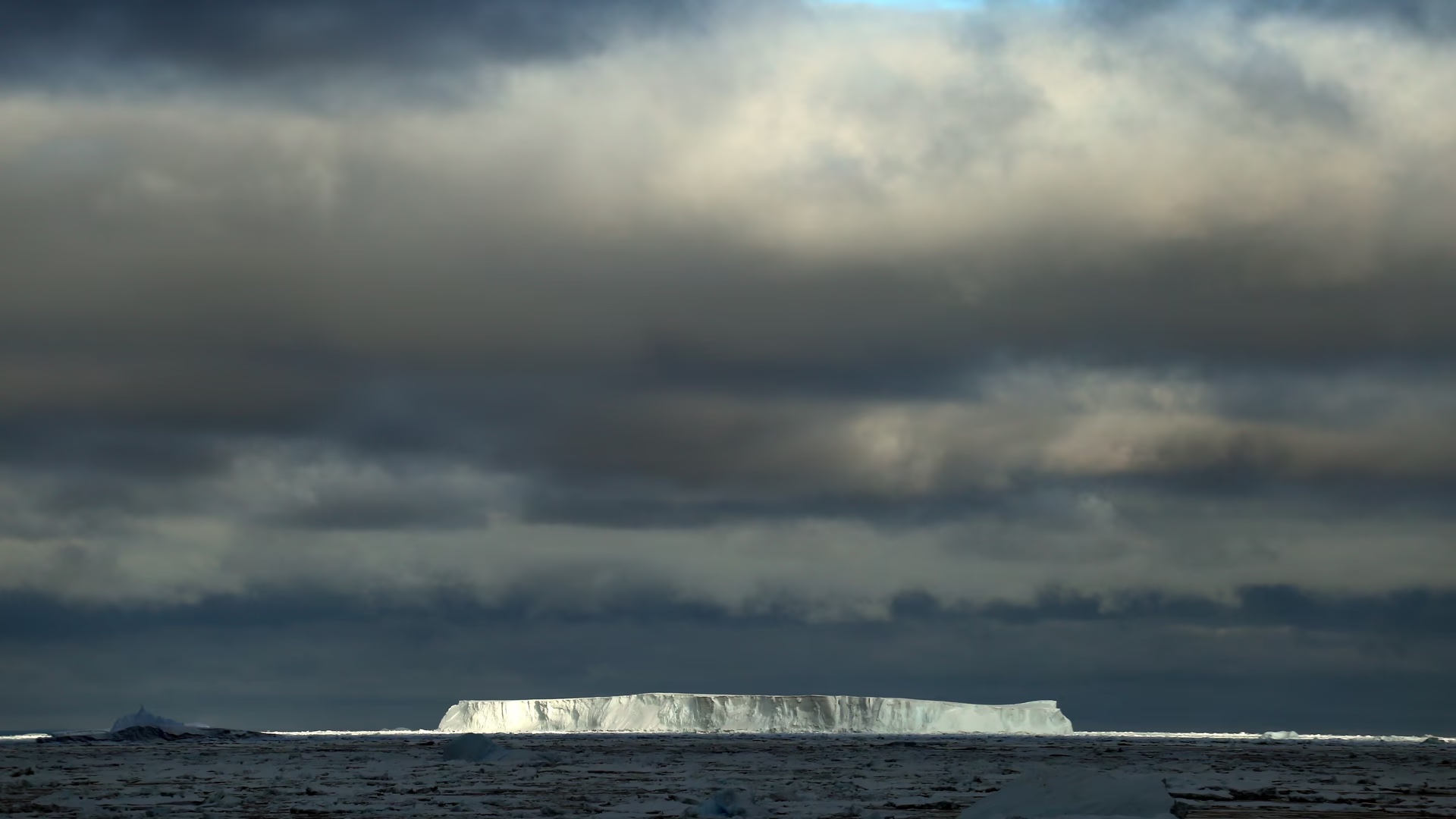
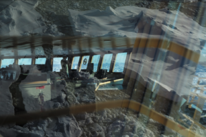
Nearly everyone onboard spends that first day up on the bridge in the shadow of Thwaites. We stand together in the difficulty of it, trying to see what sits right in front of us. A slab cantilevers out over the water like the scalloped shell of a giant clam, studded with icicles formed during the recent warm days. I set up my camera to take a series of time-lapse photos. The shutter opens and closes, opens and closes. The art critic John Berger’s famous phrase “Seeing comes before words” rises to the surface of my thoughts. To see is also to be seen, he argues, to imagine yourself in the eyes of the other. How do we appear from the glacier’s perspective? The morning we cruise past is, in glacial time, nothing more than a blip.
Inside, the mates track the Palmer’s progress on a paper map. According to their faint pencil marks, we are currently on top of the Thwaites Glacier Tongue. Back in 1991, when the chart was printed, this area was frozen solid, a part of the Eastern Ice Shelf that extended miles farther out into the Amundsen Sea. Rick calls me over to the navigational console to look at the Palmer’s electronic course-plotting system. In the image on the screen, water appears blue, the ice shelf gray, the place where we sail white and “unnamed,” unvisited.
Rob Larter, the chief scientist, is busy watching the monitor that displays the depth of the seafloor in real time.
“It’s over 1,000 meters deep,” he says. “Deeper than the gravity-inversion models predicted.” Just like that, on our very first morning, we make a discovery: that more water is likely working its way under the glacier than we thought.
I sprint to the galley, scarf down two hard-boiled eggs and half a cinnamon bun, then run back up, taking the stairs two at a time. Soon I am outside again, looking away as little as possible. Thwaites’s calving edge stretches just under 100 miles, and so it takes us hours to travel its length. Sometimes the margin appears steep and sturdy and sheer; in other places, it loses its sheen, seems chalky and distressed. We turn a corner, and the face rockets upward into a wall. A wild line twists along the top of the shelf, tracing gorges into the blue-white snow. Then, just as abruptly, the parapet has crumbled, cluttering the water with floating pieces of brash ice.
A switch flips when we arrive at Thwaites. There is no more of the “keeping busy” that saw us through the beginning of our journey. No more sauna club or bridge lessons. No more Ping-Pong down in the hold or king cake at midnight. All that matters is data. Mud samples, seafloor depths, temperature readings, and wave action; we even keep a real-time log of sea-ice observations. Hypothetically, each of the different teams slices their days in two: Some people work from noon to midnight and others from midnight to noon. But most rest only when skating dangerously close to delirium.
We labor nonstop for nearly a week.
Then something shifts again.
Down in the dry lab, Rob hunches over his silver laptop. He’s got two windows open and is clicking back and forth between them. Both contain aerial images of the study area, the first satellite information to have made its way on board in well over a week. In one, Thwaites’s western front is a sturdy rampart. In the other, it looks as if someone took a baseball bat to a windshield. Rob toggles between the two. Cohesive shelf. Exploded lodestar. A navigable bay, then the same inlet cluttered with a surreal confetti of bergs.
“The morning we arrived, we cruised right along the edge of the shelf,” I say, looking at the first image. “It was pretty smooth, a solid wall of ice. There was some rumpling and slumping, but––”
“But over the last few days, there appears to have been a real significant release of bergs directly south of us, from Thwaites’s ice front,” Rob says, finishing my thought. Bewildered, he touches his dry palms to his muddy pants. In my stomach, a strange flutter, half fear, half excitement. This is also why we are here: to witness the disassembling that we previously only imagined with words, with calculations born from remote satellite images, with mathematical models. That disassembling, it appears, is unfolding right in front of us.
“It looks nearly as dramatic as the Larsen B collapse,” Rob says. (I reported his reaction in National Geographic at the time.) He is referring to one of the largest recorded examples of ice-shelf collapse in human history. In 2002, scientists monitoring the peninsula through aerial satellite imagery watched in both amazement and horror as much of the Larsen B Ice Shelf (a chunk about the size of Rhode Island) fell apart over a period of less than two months. In the years after the collapse, ice made its way into the bay as much as eight times faster than before, proving that when a shelf disintegrates, the glaciers it held in check can dump far more of their mass into the ocean. Which means that in the days and years following this collapse, the flow of Thwaites might also accelerate. Data from our mission suggest that sometime over the past couple of centuries, Thwaites retreated two to three times faster than what we see today, signaling that more significant ice loss is possible. (Four and a half years later, there is still not a comprehensive study of the ice-loss rates in the years following this breakup.)
The folds of Rob’s faded jumpsuit appear bleached in the lab’s fluorescent light. The gray pouches beneath his bright-blue eyes sag. He clicks from one image to the next again and makes an involuntary sound between a sigh and a grunt.
“Have you ever been on a ship where something this dramatic has happened in the area where you were working?” I finally ask. It is, after all, Rob’s 20th time in Antarctica.
“I haven’t, no,” he says quietly.
All of our remaining work in this unnamed bay is canceled. The less than a week we spent working along the western portion of Thwaites: that is the only time we will have. And now it is over.
Up on the bridge, the second mate listens to speed metal while steering us away from the minefield of the collapse. Eventually I step outside and turn in a full circle but rarely catch sight of the horizon line, so full is the sea with recently calved bergs. I have wanted to see a glacier calve for nearly a decade. In my mind, the ice would creak and groan, the ship’s deck would tremble, clouds of dust would rise up into the bright-blue vault of the sky, walls of water would surge toward us. Bearing witness to such collapse, how could something not shift?
But this is nothing like what I expected. No cleaving cliff faces. No echoes of rapture. I turn the circle again. To my right, an iceberg bigger than the college campus where I teach. Behind it, another, and another. Some have soft white snouts, and others are glossy, their edges shining sharply in the sun. When a glacier steps back or surges in the Arctic, those who live with the ice say it is sending a message. For as long as I have known Thwaites’s name, I imagined receiving that message, that this moment of its breaking would ring through my body as warning. But I never considered the possibility that the cracks would be so large, I wouldn’t know they were cracks. That I wouldn’t be able to distinguish berg from shelf, something whole from something broken. I search my memory for signs of collapse, for something—anything—dramatic. Just this morning, I asked one of the researchers onboard about the bergs, and yes, she confirmed that they came from Thwaites. If we had arrived a day ago, I think, we would believe that this was the way it was supposed to be.
This article was adapted from Elizabeth Rush’s forthcoming book, The Quickening: Creation and Community at the Ends of the Earth.
Visit Elizabeth Rush’s Speaker Profile: